Geodetic GPS (Global Positioning System) is an important device in the world of mapping and measurement, especially for land surveying, geospatial mapping, construction, mining, and scientific research.
Its ability to provide measurements in long distances and difficult terrain is one of the geodetic GPS functions.
If you are not familiar with this tool, you should read this article until the end, because you will get information about geodetic GPS from the definition, function, features, to the regulation of its use in Indonesia.
What is a Geodetic GPS?

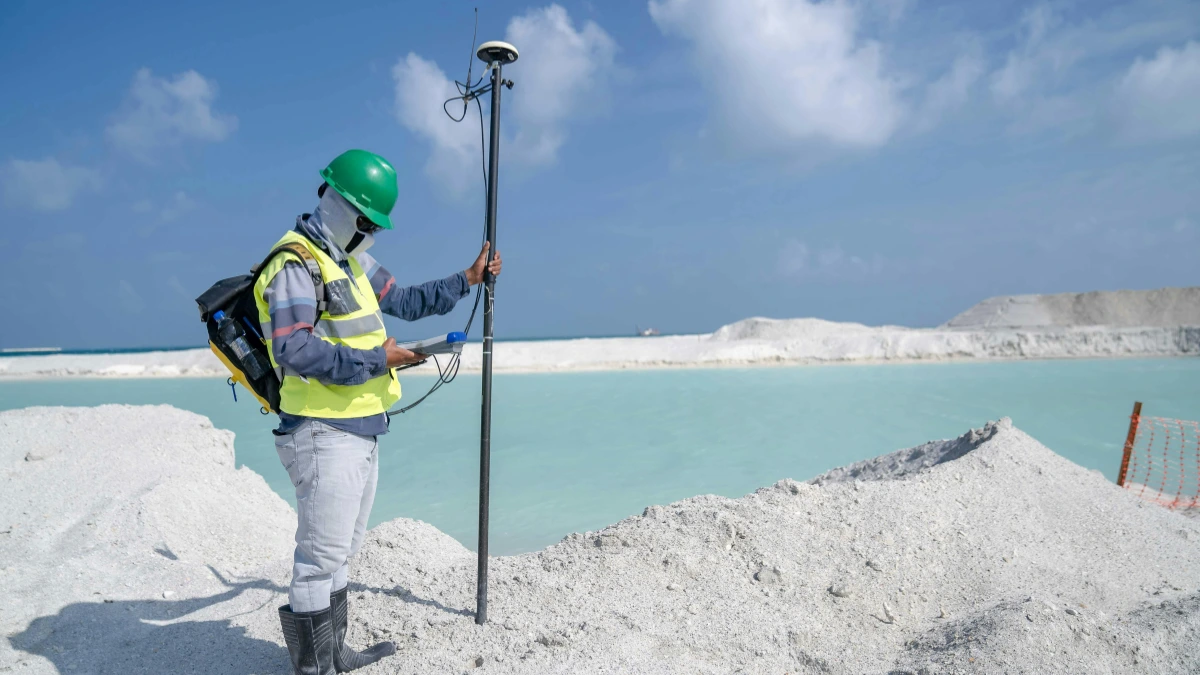
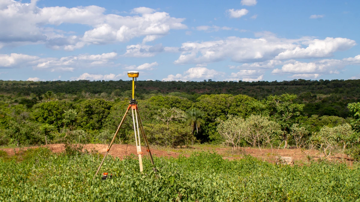
Geodetic GPS (Global Positioning System) is a position monitoring system that also uses satellite signals to determine the location of a point on the earth’s surface to the centimeter or military level. This tool is essential in applications that require high precision such as land surveying, geospatial mapping, construction, mining, and scientific research.
The reference of this GPS is the GNSS (Global Navigation Satellite System) system which is a coverage of various global navigation satellite systems belonging to Russia (GLONASS), Europe (GALILEO), China (BEIDOU), Japan (QZSS), India (IRNSS), and including the United States (GPS).
The Functions
Geodetic GPS (Global Positioning System) has many functions, especially in providing accurate measurements to the smallest detail. Here are some of the functions of geodetic GPS:
- Determining accurate coordinates: Position (X, Y, Z coordinates) can be determined with high accuracy.
- Mapping and cartography: Data can be processed into accurate digital maps for the needs of mapping agencies.
- Ground movement monitoring: Can monitor changes in ground position, especially in landslide-prone areas.
- Long distance and difficult terrain measurement: Can be used in difficult terrain as it does not require a direct line of sight between points.
- Environmental change monitoring: Can monitor land and topographic changes over a long period with high accuracy.
The Features
Geodetic GPS (Global Positioning System) has many features in supporting measurements. Here are some of the main features of a geodetic GPS:
- GNSS measurement: Uses the global navigation satellite system (GNSS) to accurately determine position.
- Real-Time Kinematic (RTK): Technology that enables real-time measurements with high accuracy.
- Internal measurement unit (IMU): Enables stable and accurate measurements in difficult field conditions.
- Connectivity and compatibility: Connectable and compatible with a wide range of CORS (Continuously Operating Reference Station).
- Software integration: This can be integrated with software for data management, analysis, and scraping of measurement results.
- Additional features: Some models feature cameras, data recording, and tilt measurement capabilities.
The Regulation in Indonesia

The geodetic GPS (Global Positioning System) uses communication technologies such as Bluetooth, ANT+, and WiFi that operate within a specific frequency spectrum. In Indonesia, any Bluetooth, ANT+, and WiFi-based wireless device is required to have DJID (Directorate General of Digital Infrastructure) under the Ministry of Communication and Digital (KOMDIGI).
Geodetic GPS regulation is based on KEPMEN No. 260 Tahun 2024 for Bluetooth and ANT+, and KEPMEN No. 12 Tahun 2025 for WiFi, which requires all radio frequency-based devices, including geodetic GPS, to meet specific technical standards before being sold in the country.
The DJID certification ensures that the product meets government safety and quality regulations and does not interfere with other communication devices. The certification process involves technical testing, such as frequency adjustments, safety checks, and compatibility with the surrounding environment.
Once the tests are completed, products that pass are listed in a Test Result Report, which confirms that the product is safe and ready for sale in Indonesia. This report reassures customers that the product meets technical standards and is secure.
For companies wanting to sell a handheld GPS in Indonesia, we are available to assist with this process. This service includes preparing technical and legal documents, conducting required testing, ensuring compliance with regulations, helping companies streamline the certification process, and giving consumers confidence in certified products. [UN]