
The first question that arises in mapping measurement is how to use geodetic GPS (Global Positioning System). This is a natural thing because this GPS is only for professional needs such as land surveying, geospatial mapping, construction, mining, and scientific research.
Although only used by professionals, by reading this article you will know the information about how to use geodetic GPS.
What to Prepare Before Using a Geodetic GPS?
Before knowing how to use geodetic GPS there are several things that need to be prepared so that its use can be maximized. Here are some things that need to be done:
- Physical condition checks: Check that there is no damage to the antenna, screen, buttons, battery, or cables.
- Fully charge the battery and carry a spare: Make sure the battery is fully charged, if necessary you can bring a spare battery in case the measurement takes a long time.
- Tool Configuration: Customize the coordinate system settings, datum, projection, zone, units, and other parameters to suit your measurement needs.
- Ensure GPS signal connection: Although the tool is not dependent on the weather to connect to satellite signals, you can make sure to keep the tool in an open area free from interference.
How to Use Geodetic GPS?

Using this tool may be a little tricky for beginners, but you’ll get the hang of it. To know how to use geodetic GPS you can follow these steps:
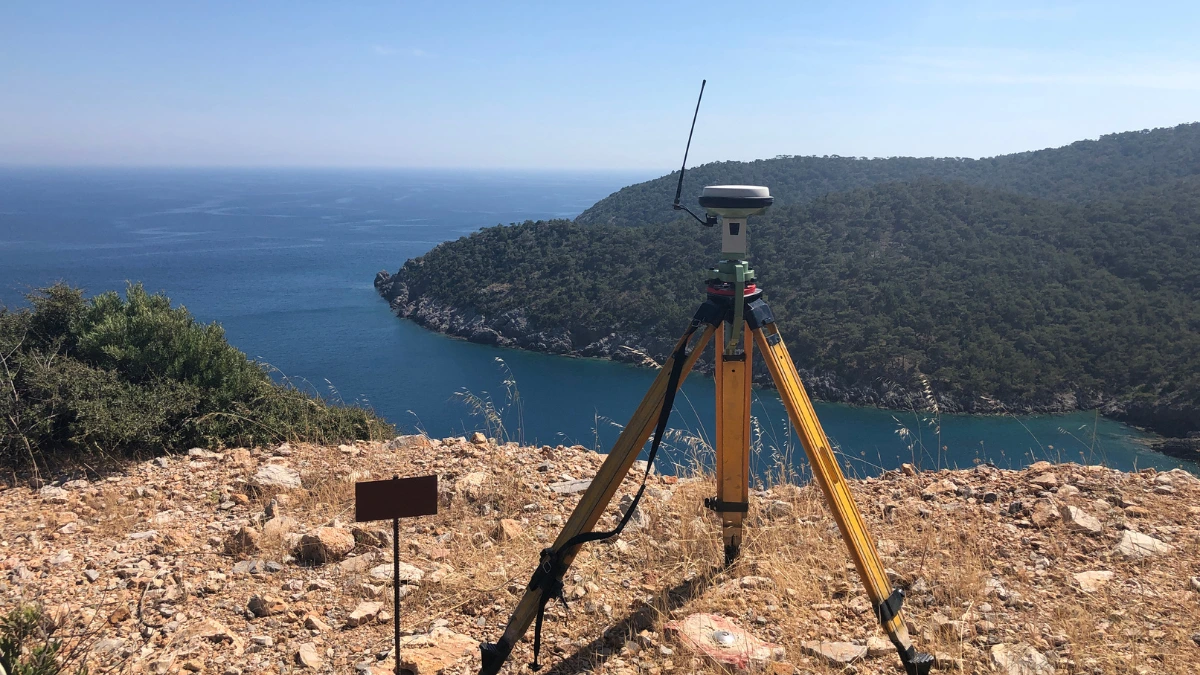
1. Positioning the tripod correctly
To get the best navigation results accurately, the first thing to do is position the tripod and tribach in the right location. Next, install the vertical extension to connect to the antenna.
2. Install the GPS antenna cable
Installation of the antenna cable can be done after you have positioned the tripod and tribach correctly. Attach the antenna cable to the antenna and GPS, remembering to measure the height of the antenna from the ground.
3. Turning on the GPS
Press the GPS geodetic power button and wait until the green indicator light appears. If the main menu has appeared you can click the surveying menu or similar until the screen display shows the satellite status.
4. Connecting to a satellite signal
Geodetic GPS can only work once it is connected to a satellite signal. Select a satellite on the screen, then wait until you get a signal from the satellite to take measurements. Weather conditions and location will affect the signal connection time.
5. Parameter settings and input
Enter the necessary parameters such as the type of measurement, antenna height, and datum used. You can find the information available in the instrument manual.
6. Data capture process
If the parameters have been entered correctly, the measurement process will then begin. The display will show the data that has been successfully recorded, make sure the recorded data is stored properly.
7. Data processing
After the data has been captured, the next step is to process the data in specialized geodetic GPS software. From here you can calculate the coordinates of the measured points based on the recorded data and perform analysis and verification related to the accuracy of the data.
That’s how to use geodetic GPS and some things to note before using it. Other things to note are that you should avoid measuring during heavy rain, keep the device away from sources of signal interference, and consult an experienced surveyor if you encounter difficulties. [UN]